
As a very active Android user, I use a lot of applications and a huge part of them are maps connected applications. Some of them help me find a way or some places, some are useful for finding information about companies, some give more information about transportation. Because currently, I’m living in Russia, I’m using Russian company’s apps such as 2gis and Yandex mobile map apps and in this article, I will compare them.
Apps Description
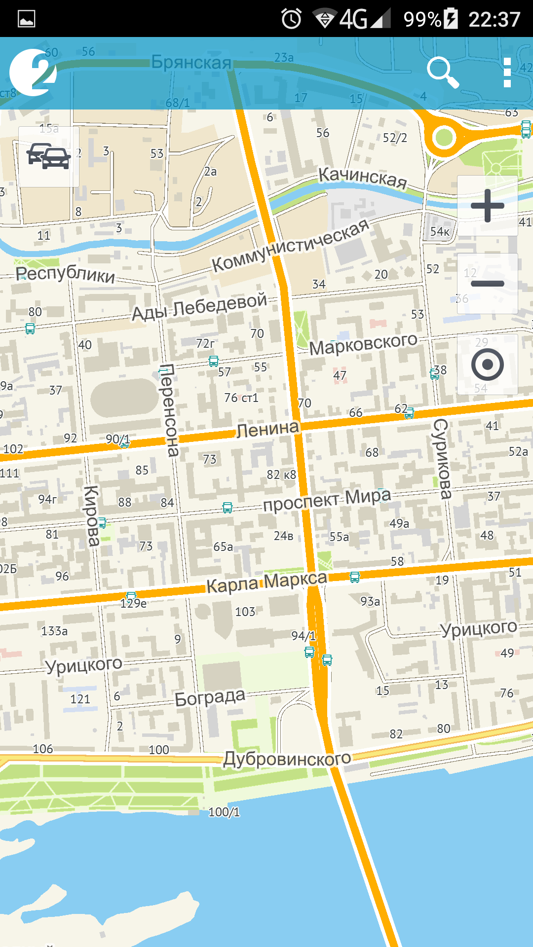
2GIS

2gis map
2GIS – https://play.google.com/store/apps/details?id=ru.dublgis.dgismobile
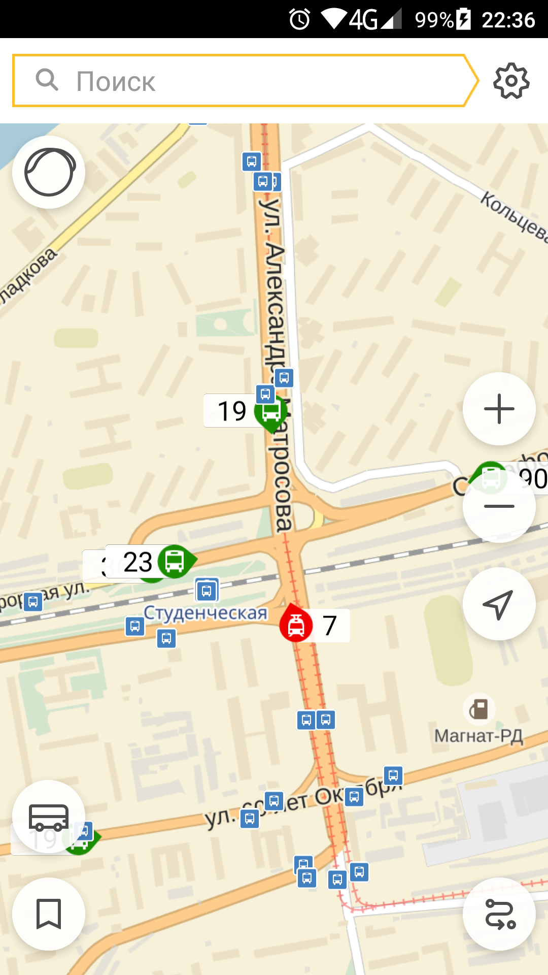
2GIS is an app made by DoubleGIS, LLC which have just over half a 1 million installs. It contains very detailed maps for wide numbers of Russian cities and other former soviet union countries and cities. Database of cities and information about them are always updated. When I travel to any Russian city I can easily find the route to any destination using these maps. Also, it provides information about transport routes. The user can click on any bus stop on the map and see which bus goes through this bus stop.
2gis beta
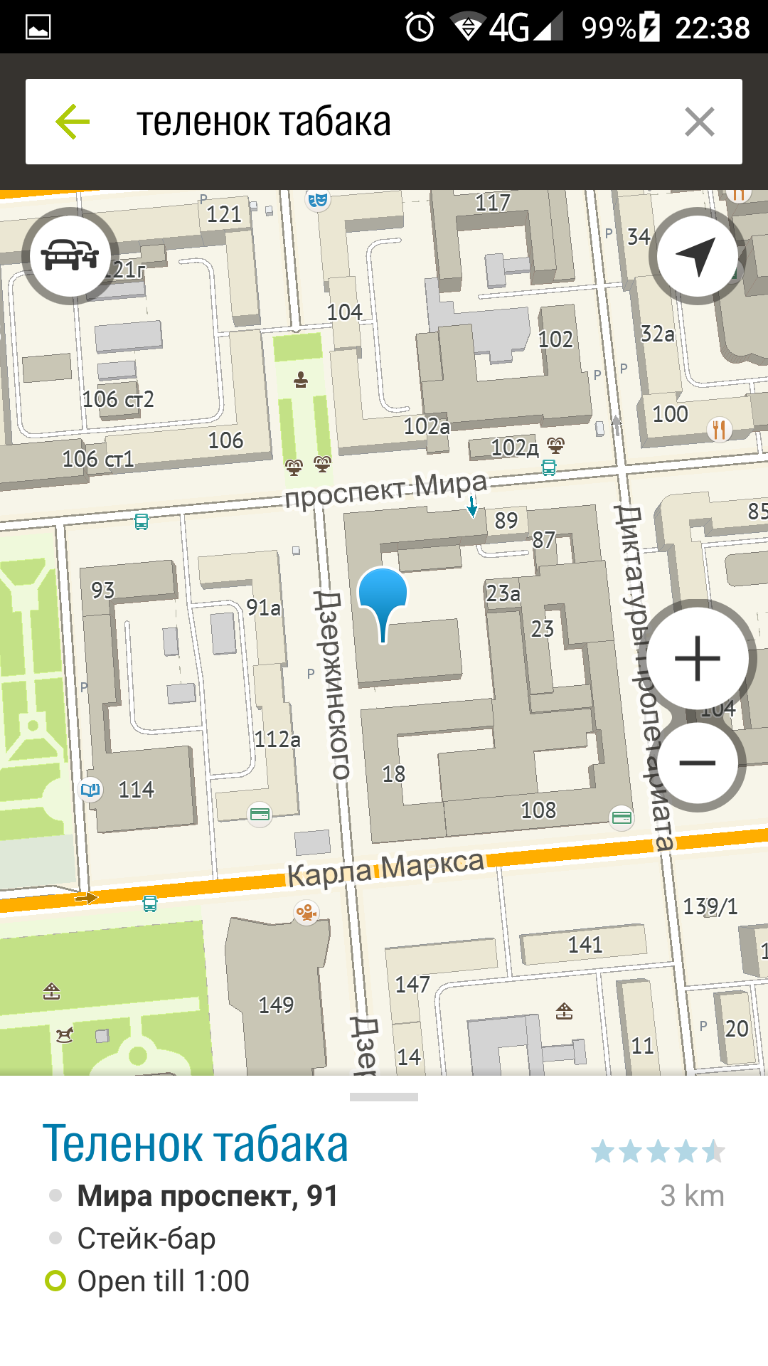
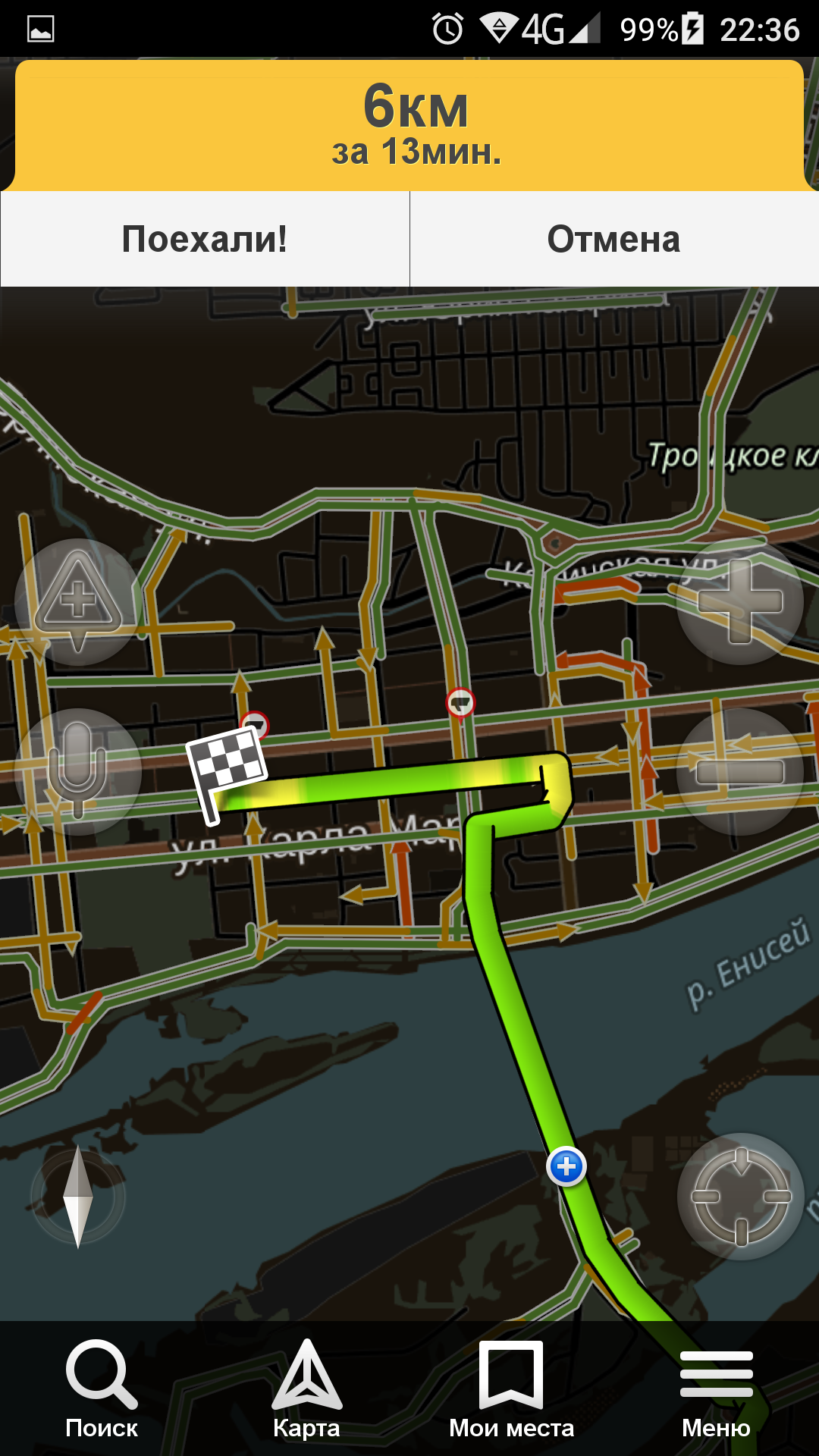
Another very useful functionality is route finding from one place to another, a user has to fill in the start and the end destination points. Also, there is a function to see the situation with traffic jams on the streets if it’s activated. To see a list of organizations located in any building user just need to click on a building on the map. There are also integrated reviews about organizations from a side web project called Flamp, which based on 2gis maps api.
2gis is available in the desktop app and web interface too, but int this article I will only review the mobile version.
2GIS is now preparing to switch to a new version and it’s already available in the app store by name 2GIS beta. This app has only about 4 thousand installs now. This version has few changes with new design and interface, but the core functionality is the same.
2GIS beta – https://play.google.com/store/apps/details?id=ru.dublgis.dgismobile4preview
Yandex
Yandex navigator
Yandex Navigator – https://play.google.com/store/apps/details?id=ru.yandex.yandexnavi
This app was designed for the purpose device position tracking on the map. It is widely used by taxi drivers and any driver will find it very useful. The driver can put his phone in special hook placed anywhere in a car, choose a destination where he wants to drive and start moving.
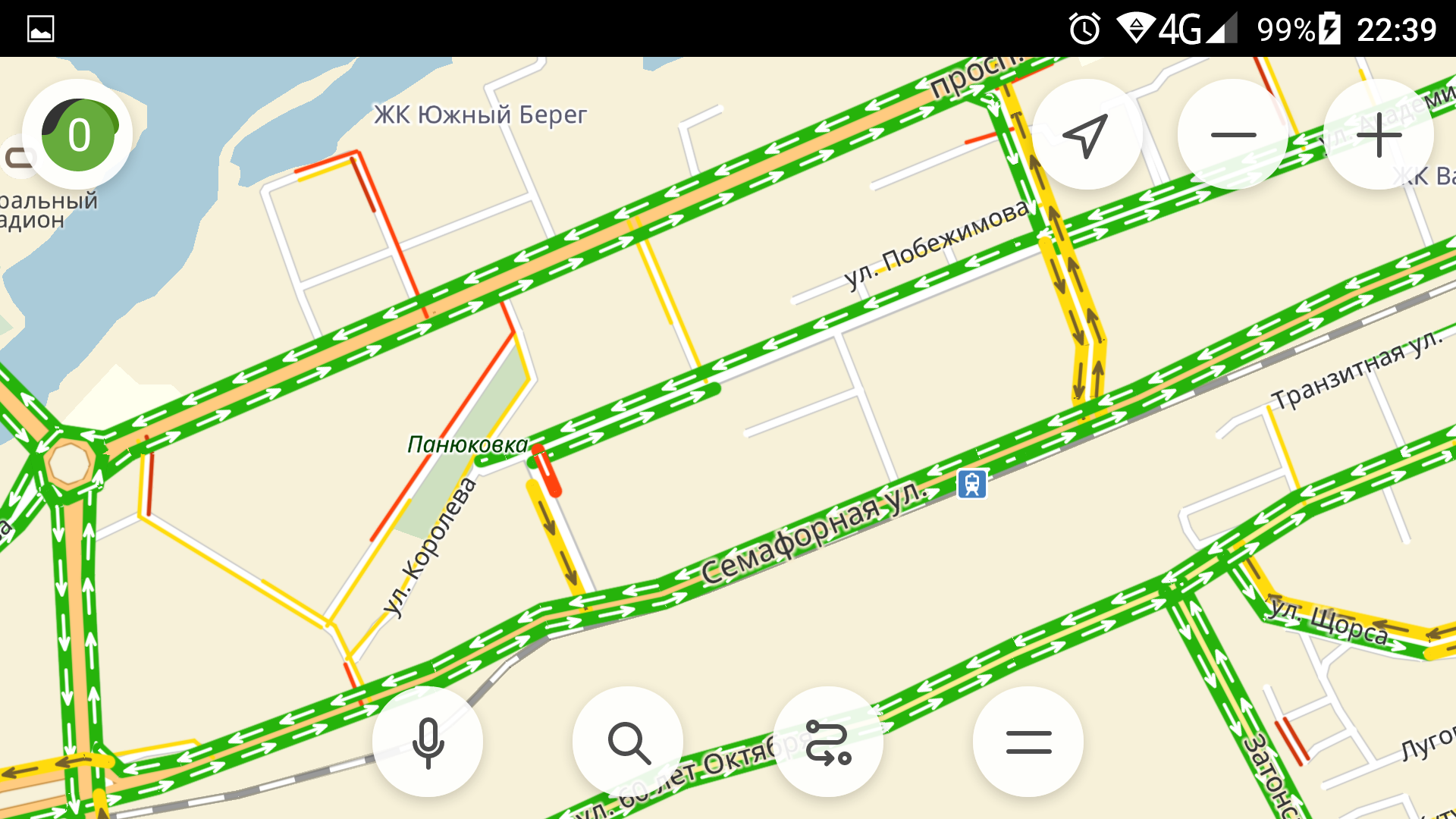
The Navigator will connect with satellites and display the current position and direction with an arrow on the route. Also, it could provide information about which side to move with voice. The Navigator has quiet a detailed map of Russian cities. The main advantage of this app is that it takes into consideration traffic accidents, road works, and other road events during route building. Also, the Navigator works in former soviet union countries, such as Ukraine, Kazakhstan, and Belarus.
2gis introduced additional functionality presented in the latest version and contains alerts about speed fixation cameras placed on the roads and also there is a list of places which could be filled by user and used while route selecting. The app has not as many installs as 2GIS but it’s nearly the same, at 470 thousand and 500 thousand respectively.
Yandex Maps – https://play.google.com/store/apps/details?id=ru.yandex.yandexmaps
Yandex maps
I will say just a few words about this app because I’m not a big fan of it. It does not contain information about organizations in buildings but has a quiet detailed map. You can see the main points of interest on the map such as administrative organizations, parks, schools and other useful places.
Also as in 2GIS app, this app has the functionality to create a route from one address to another using public transport or a car. And another functionality to mention is address searching (2GIS has it too) and address input with voice. The app has some own review system for places but I don’t know how can this be useful without info about the organizations.
Yandex transport
Yandex Transport – https://play.google.com/store/apps/details?id=ru.yandex.yandexbus
The main advantage and the purpose of this app are to track buses on their routes and display them on the map online in the area around the user.
Overall, the area is not restricted and users can see the location of the bus that they are waiting for, on any point on the map. It’s very useful to know where are specific buses, especially when the user is waiting for the bus on the stop. From a psychological point of view, knowledge about how much time person needs to wait helps to reduce irritation caused by waiting. Also, the app is helpful for planning when it’s comfortable to leave the current place and go to a bus stop to catch needed bus.
My opinion and comparison of apps as user
Among several apps used most of the time by me is 2GIS and Yandex Transport. When it comes to 2gis app I use it always when I’m in the city on the streets, when I’m looking for some place or how to get to specific address. Also, 2GIS with their database of organizations is irreplaceable for searching of organization address or, for example, looking for a phone number or checking organization working hours.
I’m always using route finding in 2GIS which suggests several options with transfers or not and using different transport, such as buses, trolleybuses, trams. It’s more comfortable for me to have all this functionality in one app. Yandex Maps, instead, works in connection with Yandex Transport and Yandex Navigator. I think all Yandex apps have the same database and differs only in functionality. When I want to find a route using Yandex Maps I can do it, but to track my progress on the route it suggests to open Yandex Navigator app. I could see buses information when I click on bus stops as in 2GIS, but there are no advantages, because when I want to see current bus position it suggests to open Yandex Transport. I don’t like this switches between apps and it would be wonderful to have all in one app with all functionality including online transport tracking.
Because switching between apps, Yandex Maps route finding is not as comfortable as in 2GIS app for me.
Yandex Maps doesn’t provide organizations information by address and map feels less rich and informative.
Maybe Yandex Maps route finding is more intelligent and accurate in time calculation, but 2GIS is quite good too and this is not the main feature for me.
So, I have almost all that I need in 2GIS except online bus positions on the map and I supplement this functionality with Yandex Transport app. And when I will drive own car, I would use Yandex Navigator a lot, but now I don’t have drive license and a car yet.
In conclusion
Both Yandex and 2GIS provide great map connected solutions for mobile devices.
I would like to see bus online tracking on the map in 2GIS app and I want the possibility to activate all functionality from Yandex Navigator and Yandex Transport just in Yandex Maps.
But since there is no choice to have all in one app I will use products from both companies.
Thank you for reading! This article was written for learning purposes because I’m attending English lessons.